


 Have you ever wished for a set of maps that was completely customizable? One set of maps on which you could isolate geographic features, rivers, boundaries, cities, etc., instead of page after page (or atlas after atlas) of different maps? Wish no more – Bright Ideas Press’ newest product provides just what you wished for!
Product Details
WonderMaps by Bright Ideas Press is a customizable set of 350 maps (60+ world maps, 60+ USA maps, and 125 historical maps (including 25 Biblical maps), and the complete (yes, I said complete!) map sets from Volumes I – III of The Mystery of History (“MOH”) and Volumes 1-2 of All American History). WonderMaps is available from Bright Ideas Press in download and/or CD format for $49.95. If you’re a TOS subscriber, check your most recent issue for a discount code. (If you’re not a TOS subscriber, why not? It’s an awesome homeschooling magazine!)
How does it work?
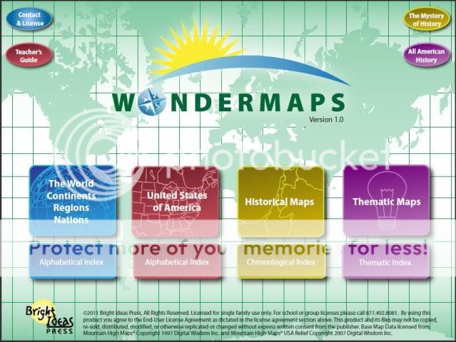
First, you choose the type of map you want (World Continents/Regions/Nations, USA, Historical Maps, or Thematic Maps).

The above picture results from a choice of World Continents/Regions/Nations. Next, choose the particular map you’d like. On this map, clicking on the blue text will zoom in, and clicking on the black text will open a new map. Let’s choose Oceania, then choose Australia – here’s what we get:

The map appears with all “layers” selected. Deselect individual map components to start peeling away the layers. From here you choose to delete information regarding state borders, state names, city/town locations, city/town names, rivers, river names, terrain, etc. Each click of a button displays a new map. You can also choose from color or black/white overlay. Click away every item, and you’re left with an outline map of Australia.
That explanation may have been a bit confusing, so here’s a tutorial video that will help explain how WonderMaps works:

What I like
My girls like to sit at the computer and click the optional “layers” on and off to see what the maps look like with/without certain features. While they’re doing that, they’re absorbing geography knowledge without even realizing it.
Love that I can print the MOH maps and don’t have to cut up my MOH books!
With the click of a button, I can have a different map. Quick and easy. For instance, we can review the names and locations of USA rivers, then I can off the “river names” layer with one quick click, print the map (or view it online), and do a quick test to see what they remember.
Bright Ideas Press has proven they have great customer service. Crew members have pointed out some errors, and they’ve been quick to respond.
We’re studying American History next year. I can choose “Thematic Maps”, “American History”, and with one more click I can see a map of the 13 Colonies Original Land Claims, or the Atlantic Slave Trade, or American Civil War Battlesites, or the Missouri Compromise, or….well, you get the idea.
Indexes of maps. Both the World Continents/Regions/Nations maps and USA maps offer an alphabetical index; the Historical Maps have a chronological index; and the Thematic maps have a thematic index. The indices make it quick and easy to find what you need. Note sometimes it takes a little time to adjust to what will be included in World maps and what will be included in historical maps.
I wish…
I wish they would call Australia Australia! On some maps that show continent names, Australia isn’t shown and instead is “lumped in” with “Oceania”. I think that’s really confusing for a child studying the continents.
The icon that is placed on your desktop at installation was a map-related image. Maybe I did something wrong, but my icon looks like a blank page with an arrow. A visual cue to help more easily find the desktop icon to launch the program would be great.
Watch out for
WonderMaps is an interactive, pdf-based program and requires Adobe Reader version 9.1 or above. If you don’t have this version, you can download it for free here.
Watch out for geography. With WonderMaps, it will become addictive.
The Mystery of History and All American History maps are not customizable, as they are identical to the maps included in the MOH and AAH volumes.
Not all maps have all “layers.”
Be sure to
Check your most recent edition of The Old Schoolhouse Magazine for a coupon. If you don’t have one, don’t worry – WonderMaps is worth every penny of the full price.
Check out the other offerings of Bright Ideas Press – Illuminations, Mystery of History, All American History, Christian Kids Explore… Click here to go to their online store.
Read a little bit about the Bright Ideas Press gang here.
Check out the articles, e-zine archives, workshop handouts, and other great offerings here.
Check out the Bright Ideas Press blog here.
If (when!) you purchase WonderMaps, be sure to register with Bright Ideas Press – that will make you eligible for free updates.
Company Contact Info
Bright Ideas Press
PO Box 333
Cheswold, DE 19936
Toll-free at 877.492.8081
Office hours: Monday - Friday. 8:30am - 5:00pm EST
www.BrightIdeasPress.com
You can also contact them online here.
Final thoughts
Love this program. I foresee using it for years to come. WonderMaps is….wonderful!
Thoughts of my crew mates
To see other reviews of this product, click here. For giveaways, other product reviews and other fun things, follow the 2010-2011 TOS Homeschool Crew blog at:

Disclaimer: As part of the 2010-2011 TOS Homeschool Review Crew, I received the product described in this review at no cost in exchange for my fair, honest and unbiased (and not necessarily positive) review. No other compensation was received.


We LOVE Wondermaps! Stopping by from the Crew :)
ReplyDelete